Cross Country Skitour in Swedisch Lapland
march/ april 2012
Pictures and Text Klaus Goerschel
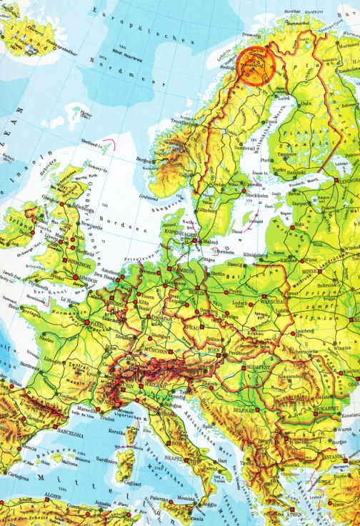
After I had travelled three days from Friedrichshafen at the Lake of Constance to Swedish Lapland I arrived at the Fjällstation Kvikkjokk tired but full of big expectations on the 7. of march about 18 o´clock.
Some years before the starting point of my first tour in wintertime with Ski, pulka and tent had been the Kungsleden.
I was very pleased with this trip, so that I had straight away undertaken a skitour in Alaska the following year. This trip with a bigger pulka and larger tent, was a very impressiv travel through Alaska.
I arrived in Kvikkjokk, only a little assembly of cabins situated immediatly on the polar circle, and planned nothing for the first time apart from some ski excursions in the direct environment.
But after a few hours in this Fjällstation, I dismissed my first plan and decided on skiing the Padjelantaleden to Ritsem immediately.
I knew the track from my first trip in Winter 2004 and I remember above all the fine weather prevailing there. So I set off in the vast distances of the white Lapland just before noon when snow was falling and the sky was dark grey.
Some scooter drivers told me there were a lot of lakes and rivers and that they wouldn´t be frozen as a result of too much snow. Take care, it might be dangerous and the best is you follow the scooter track on lakes. It was clear that the scooter drivers had to find new ways and that should also be my track as long as possible.
This travel report is devided into 3 parts. Click here:
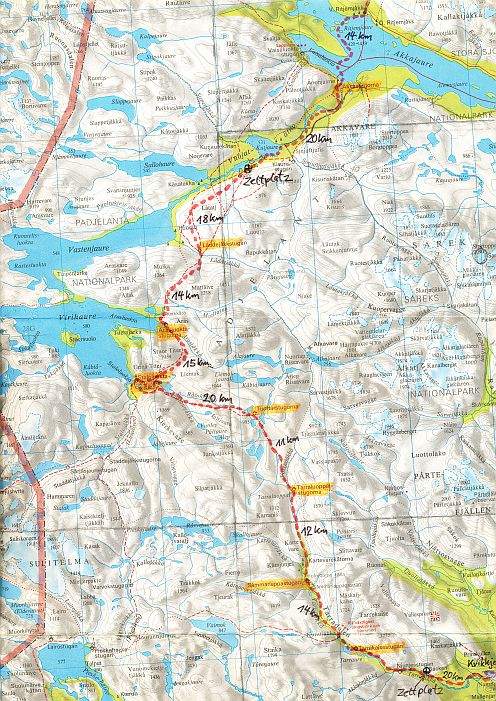
Map for part I
On the Padjelantaleden from Kvikkjokk to Ritsem 154 km, 10 days skiing and 2 days rest due to snow storm.
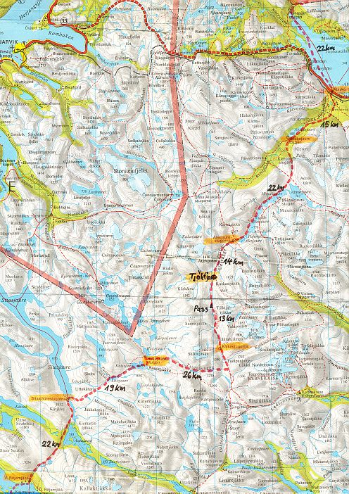
On the Nordkalottleden from Ritsem to Abisko 131 km. 7 days skiing and 1days rest
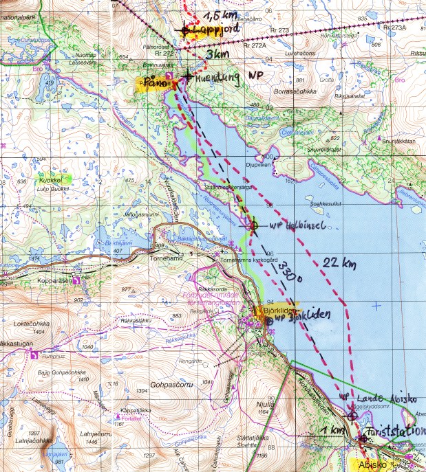
In the swedish Fjällkarta 1:100 000 BD6 you can see my trip on the Nordkalottleden to Lappjordhytta 25 km on the lake Torneträsk. From Lappjordhytta I skied 1,5 km around to the west of the Lullehacarro mountains and had to return to Lappjordhytta. From there I went downhill 3 km to the lake Torneträsk und Palnostugan. I changed my plan of spending the night in the Palnostugan and went back to the Waypoint "Lande Abisko" in the middle of the Lake. Late in the evening I camped at the lakeside. The waypoints marked in the map I had transferred in my GPS.
Map for part III
On the Nordkalottleden from Abisko at the back of Lappjordhytta and back to Abisko 53 km, 3 days